


GeoPackage
Geopackage Tags
All GeoPackages
ℹ️
Geopackage files that contain a QGIS project file and all the data layers used in the project.
24 records found.
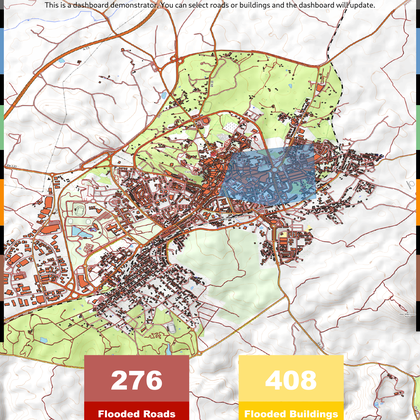
QGIS Dashboard
by Tim Sutton, 14 December 2020
This is a demonstrator project to show how you might use labels to create a …
Updated on 30 May 2024
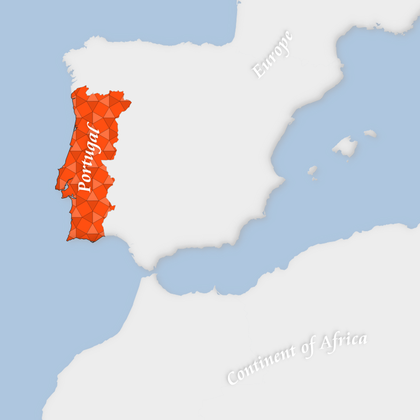
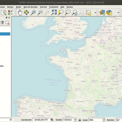
Portugal Small Scale Map
by Tim Sutton, 16 December 2020
Simple map showing some layer effects, curved labels and a nice fill style from the …
Updated on 28 May 2024
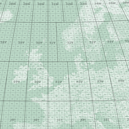
Military Grids - Tools and Example data and Layouts
by Klas Karlsson, 31 December 2020
This package includes a project with project processing models that help you generate MGRS grids …
Updated on 29 May 2024

QGIS Server with docker walkthrough
by Tim Sutton, 08 January 2021
This is a resource pack to accompany the YouTube video I have posted here: https://youtu.be/1rSs3o8OoQ8 …
Updated on 25 May 2024
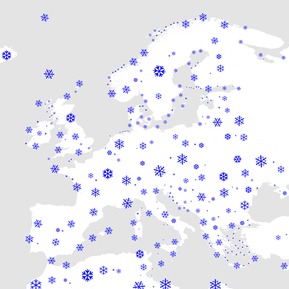
Snowy Day
by Anita Graser, 29 December 2021
This project features the "snowy day" layer style: using only unicode snowflake characters and rule-based …
Updated on 28 May 2024
Blended Line Ends Demo
by Tim Sutton, 13 February 2022
The Kartoza GIS gals and I were fantasizing about being able to make this effect …
Updated on 25 May 2024
My plot - Mon parcellaire
by Jean, 28 February 2022
GPKG demonstration hosting open data, Mon parcellaire is a simple data model to describe your …
Updated on 27 May 2024
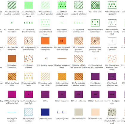
UK Phase 1 Habitat Survey project
by Caplin, 04 November 2022
This is my Phase 1 Habitat Survey digitisation project, I have included my Phase 1 …
Updated on 30 May 2024
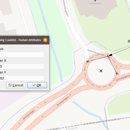
Feature Radius Measurement
by Klas Karlsson, 24 July 2023
With this project you have a template to create a collection project that measures curve …
Updated on 30 May 2024
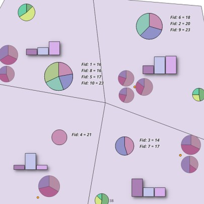
Charts and Diagrams Example
by Klas Karlsson, 10 September 2023
This package contains some very simple data and examples of the built in diagrams and …
Updated on 29 May 2024
Curved Layout Text Example
by Candido, 21 June 2024
This example shows how to create curved text in QGIS Layouts using dynamic SVG graphics …
Updated on 27 June 2024
Common_startingPoint V01
by Sarig, 04 November 2024
Built as a starting point for any new project with ready made project and layers …
Updated on 28 November 2024
SVG Labels
by Candido, 04 February 2025
This GeoPackage file contains a QGIS project ("SVG-Label") which shows how to use SVG graphics …
Updated on 05 February 2025
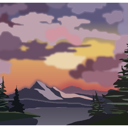
Sunset Aglow - Bob Ross in QGIS - recreated by Hefni Rae R A
by Azzahra, 31 March 2025
Hi, I'm Hefni. I recreated traditional painting from Bob Ross using GIS Software.
Updated on 31 March 2025
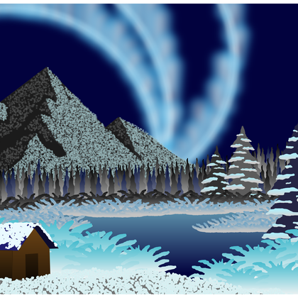
Northern Lights - Bob Ross in QGIS - by Lindie Strijdom
by Strijdom, 03 April 2025
A digital recreation of Bob Ross's Northern Lights, created for the 2025 Kartoza internship. The …
Updated on 09 April 2025
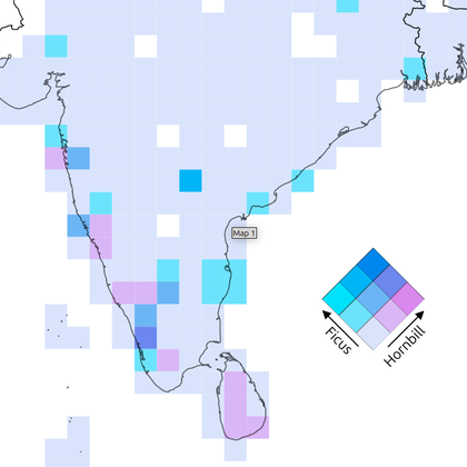
Sample Bivariate Map in QGIS
by Asj, 09 May 2025
This is a sample QGIS project showing a bivariate map created using iNaturalist data. The …
Updated on 12 May 2025
Curated & Organized Basemaps - Project Template
by Denney, 20 May 2025
This project is just a curated & organized list of xyz tile basemaps. The basemaps …
Updated on 23 May 2025
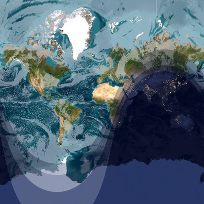
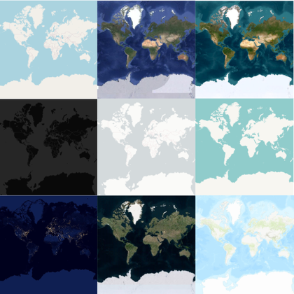
The Earth - Right Now!
by Denney, 27 May 2025
This project shows the earth, right now! 🌍 Well... kind of. I wanted to create …
Updated on 28 May 2025
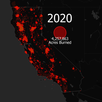
Time Series - California Wildfires
by Denney, 28 May 2025
This project is an example of how to visualize time in QGIS, and use the …
Updated on 30 May 2025
Showcasing attribute data validation methods
by Hovens, 25 June 2025
This project showcases different methods to identify attribute data that does not comply with custom …
Updated on 26 June 2025


