
This GeoPackage is made available under the CC-0 license.
This project shows the earth, right now! 🌍 Well... kind of.
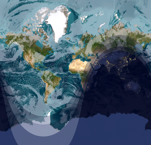
I wanted to create a project that, as best I could, shows a global image of what the earth looks like at the current moment. This is the best I could come up with, showing real-time layers for the horizon and cloud cover. The day/night horizon is a live layer, updating every 100 seconds (thanks Esri). The clouds layer, from Open Weather Map, is also updated continuously.
The imagery layers do not update continuously of course, and the night imagery does not work great at high zoom levels. I used group layer masking so that regular imagery shows for the daytime, and the night imagery is only shown in the part of earth that is current in night.
This project does load slowly, and does not work great at higher zoom levels. But I hope people have fun with it!
Have some ideas on how to make this project better? Please comment below ⬇️⬇️⬇️
Thank you very much!
Reviewed by gabrieldeluca 10 months ago

This GeoPackage is made available under the CC-0 license.

Flagship membership

Flagship membership

Large membership

Large membership

Large membership

Large membership

Large membership

Large membership

Large membership

Large membership

Large membership

Large membership


