
This GeoPackage is made available under the CC-0 license.
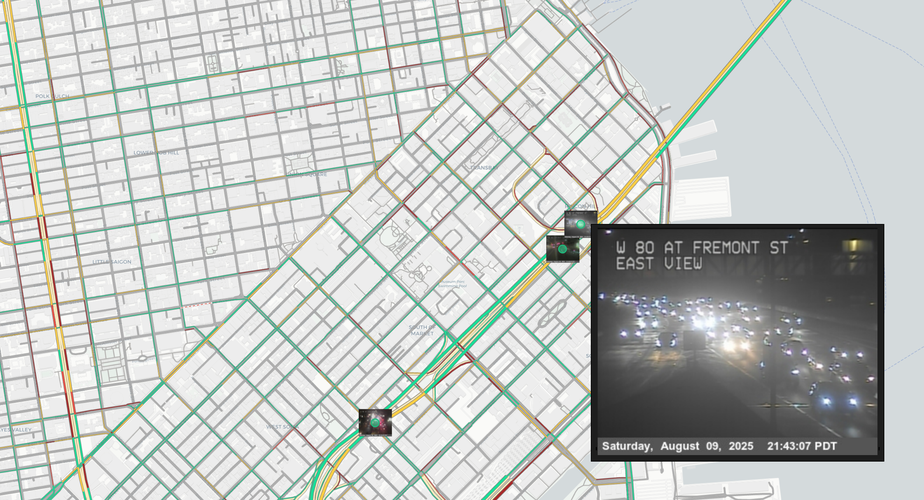
This project shows live traffic conditions on California roadways. The project demonstrates a few cool features in QGIS, particularly displaying live and dynamic media in attributes forms, map tips, and symbology. Similar to the "Earth - Right Now!" project I uploaded a few months ago, I like using QGIS to show live information.
The project contains the ~3,000 locations of live traffic cameras operated by Caltrans (the department of transportation in California). These points display the most recent image from each camera in a few ways. First, the images display when zooming in close to a point. Users can also interact with the points using the Identify Features tool. Hovering over points will display the most recent image, and clicking on points will show a popup with that image. The popup also include a button that links to a live video feed for that camera. This will open in a browser.
To add one more dimension to the live traffic visualization, a basemap including Google's current traffic conditions is used. It is quite fun to see how the images correspond to the roadway traffic colors!
Not all points have video feeds, some are just still images. Also, many cameras go offline occasionally, but usually come back online over time.
Great, thank you!
Reviewed by gabrieldeluca 7 months, 2 weeks ago

This GeoPackage is made available under the CC-0 license.

Flagship membership

Flagship membership

Large membership

Large membership

Large membership

Large membership

Large membership

Large membership

Large membership

Large membership

Large membership

Large membership


