Layer Definition File
ESRI Sentinel-2 10m Land Cover Download 2017 - 2025
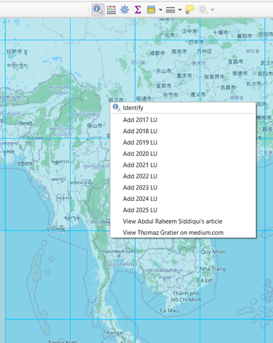
A 10-meter Sentinel-2 10m land use/land cover time series of the world from 2017 to 2025 produced by Impact Observatory, Microsoft, and Esri.
QGIS versions: 3.x & 4.x
Steps 1. Open the qlr file in QGIS. 2. With identify tool, right click over the desired UTM grid, from the popup menu, choose landcover year to download.
Note for QGIS 4.x users For security reason, QGIS 4.x will not allow the script to run in the "Untitled Project". Open the qlr in a named project. If security prompt popups, chose "Trust" or "Always Trust".
19 July 2026
19 July 2026
19 July 2026
Kyaw
arcgisfeatureserver
land cover
sentinel-2
Great work! Thank you!!
Reviewed by gabrieldeluca 2 months, 1 week ago
gabrieldeluca approved these changes 2 months, 1 week ago
Creative Commons Attribution 4.0 (CC BY 4.0)