This Map is made available under the CC-0 license.
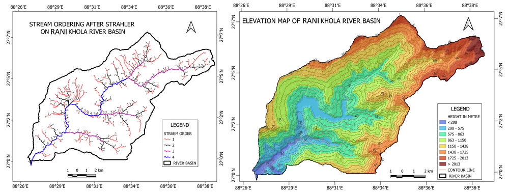
The map illustrates the stream ordering and elevation characteristics of the Rani Khola River Basin. The left panel represents the drainage network classified according to the Strahler stream-ordering system, identifying four stream orders. First-order streams dominate the basin and gradually combine to form higher-order channels, with the fourth-order stream representing the main drainage channel. The right panel depicts the spatial distribution of elevation, ranging from below 288 m to above 2,013 m. Lower elevations are predominantly concentrated in the southwestern and central parts of the basin, while higher elevations occur mainly along the northern, eastern, and peripheral regions. The contour lines further illustrate variations in terrain and slope. Overall, the maps highlight the basin's drainage hierarchy and topographic variability, providing useful insights into its hydrological characteristics and geomorphological structure.
Thank you!
Reviewed by gabrieldeluca 10 hours ago

This Map is made available under the CC-0 license.

Flagship membership

Flagship membership

Flagship membership

Large membership

Large membership

Large membership

Large membership

Large membership

Large membership

Large membership

Large membership

Large membership