
This Map is made available under the CC-0 license.
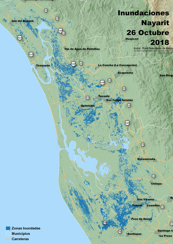
A map showing flooded areas in the the State of Nayarit, Mexico, after the Willa hurricane in 2018. Areas identified using Sentinel 1 imagery.
Thank you for sharing!
Reviewed by timlinux 1 year ago
Thank you!
Reviewed by gabrieldeluca 11 months, 3 weeks ago

This Map is made available under the CC-0 license.

Flagship membership

Flagship membership

Large membership

Large membership

Large membership

Large membership

Large membership

Large membership

Large membership

Large membership

Large membership

Large membership


