
This Map is made available under the CC-0 license.
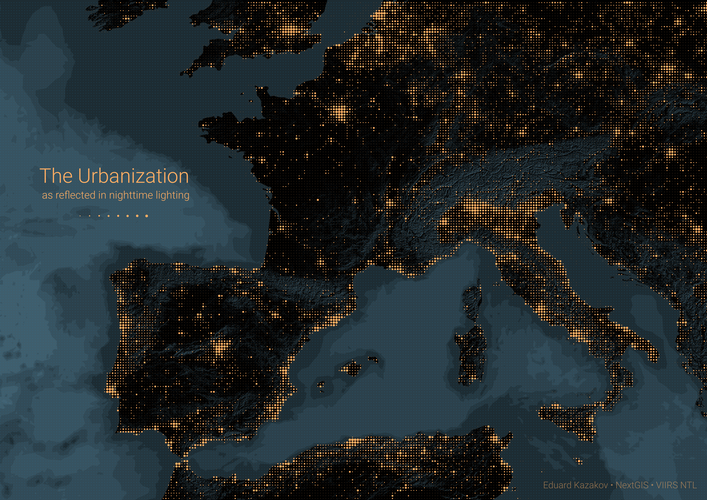
Night lights were derived from VIIRS data and processed in QGIS. A regular grid was used to aggregate night light intensity, with circle size representing the average intensity in each area.
Hi, Thank you for your submission. Very nice map!
Reviewed by gabrieldeluca 1 year ago

This Map is made available under the CC-0 license.

Flagship membership

Flagship membership

Large membership

Large membership

Large membership

Large membership

Large membership

Large membership

Large membership

Large membership

Large membership

Large membership


