
This Map is made available under the CC-0 license.
Open Full-Size Map - To see animation.
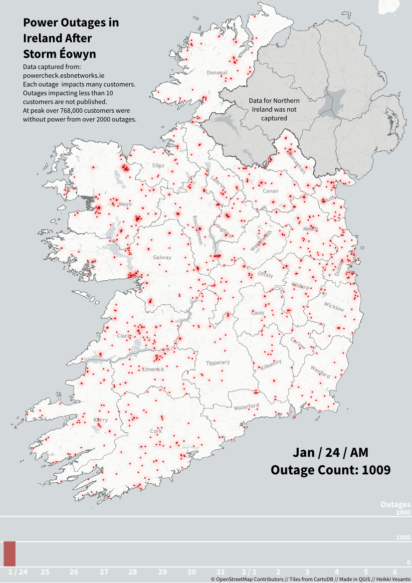
Storm Éowyn had a significant impact, particularly in Connemara and the Midlands of Ireland. Where the storm left widespread devastation, with over 130 power outages still being recorded two weeks later by ESB Networks, despite thousands of outages being fixed in that time.
The outages peaked at over 2000 outages impacting 768000 customers in the Republic of Ireland.
Creation:
Download the data from: https://powercheck.esbnetworks.ie/ twice a day for 2 weeks. Data is in a JSON.
Parse the data into a PostgreSQL database with PostGIS using Python. Making sure to have a "capture_date" field for when the data was downloaded.
Create a "driver" table. A table with the unique times you have data for and the counts you want to appear in the animation. This "drives" the atlas creation. The clever part in this animation is that the driver table is the graph at the bottom, I created arbitrary geometries 0,1 1,0 2,0 ect.. with data driven symbology. So the graph at the bottom is a "map" as well.
Create your symbology. The points have a rule based symbology to only show when their "capture_date" matches the atlas "capture_date"
Create a print composer that is driven by the atlas generator. To cycle through the dates.
Use imagemagick to stitch the frames into a gif.
Hi! Thank you very much, for the animation and the procedure, it's great!
Reviewed by gabrieldeluca 11 months, 3 weeks ago
Just approving- I assume you meant to approve it Gabriel?
Reviewed by timlinux 11 months, 3 weeks ago

This Map is made available under the CC-0 license.

Flagship membership

Flagship membership

Large membership

Large membership

Large membership

Large membership

Large membership

Large membership

Large membership

Large membership

Large membership

Large membership


