This Map is made available under the CC-0 license.
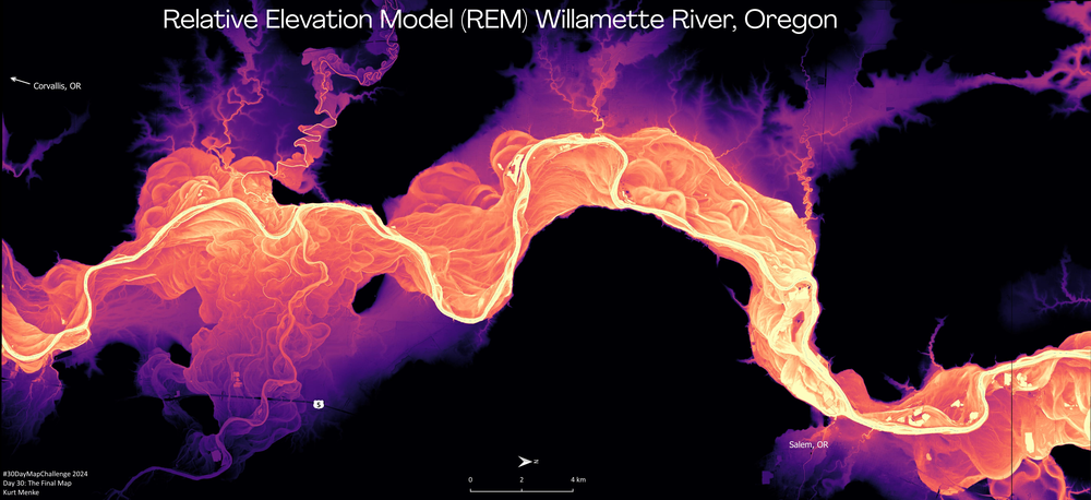
This map was done for the 2024 #30DayMapChallenge It shows the Willamette River between Corvallis and Salem Oregon. A Relative Elevation Model (REM) is also known as a height above river raster. The DEM is detrended to the baseline elevation of the river. I used the IDW method detailed by Dan Coe Carto: https://dancoecarto.com/creating-rems-in-qgis-the-idw-method
Hi! Nice map, thank you!
Reviewed by gabrieldeluca 1 year, 3 months ago

This Map is made available under the CC-0 license.

Flagship membership

Flagship membership

Flagship membership

Large membership

Large membership

Large membership

Large membership

Large membership

Large membership

Large membership

Large membership

Large membership