
This Map is made available under the CC-0 license.
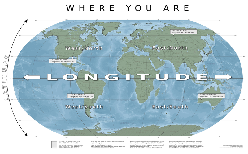
A map explaining the workings of un-projected coordinates in latitude and longitude. Made in QGIS using Natural Earth data. Finishing touches like curved labels in the layout was made using Inkscape.
Thanks Klas!
Reviewed by timlinux 1 year ago

This Map is made available under the CC-0 license.

Flagship membership

Flagship membership

Large membership

Large membership

Large membership

Large membership

Large membership

Large membership

Large membership

Large membership

Large membership

Large membership


