This Map is made available under the CC-0 license.
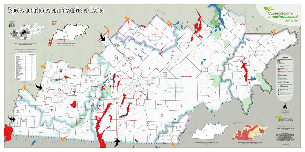
This 6 x 3 feet (this is a low resolution version) map was created (100%) in QGIS. It is a portrait of the aquatic invasive species in southern Quebec, Canada. It represents the different species present and the infected lakes. The map was made using open data from Government of Quebec and invasive species observations comming from different organizations. It was designed to be printed full scale and displayed in enviromental education events.
Thank you!
Reviewed by gabrieldeluca 1 year, 3 months ago

This Map is made available under the CC-0 license.

Flagship membership

Flagship membership

Flagship membership

Large membership

Large membership

Large membership

Large membership

Large membership

Large membership

Large membership

Large membership

Large membership