
This Map is made available under the CC-0 license.
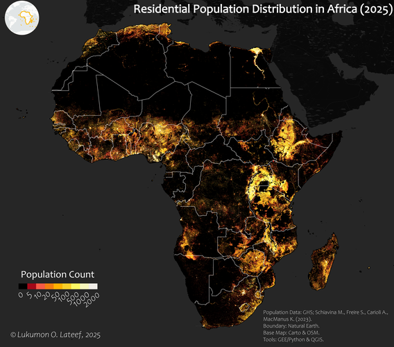
The Global Population Surfaces from Global Human Settlement Layer (GHSL) data, downloaded from GEE, was imported to QGIS. Then, the symbology was changed in QGIS to show the population distribution, and the print layout was used to create an aesthetic map of the population distribution. Also, basemaps were added to the map using the 'QuickMapServices' Plugin in QGIS. The workflow I used and the QML symbology file are made available in this GitHub repository for reproducibility: https://github.com/Surv-Lukmon/Awesome-Population-Visualization
Thank you very much!
Reviewed by gabrieldeluca 11 months, 1 week ago

This Map is made available under the CC-0 license.

Flagship membership

Flagship membership

Large membership

Large membership

Large membership

Large membership

Large membership

Large membership

Large membership

Large membership

Large membership

Large membership


