
This Map is made available under the CC-0 license.
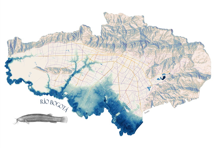
Map showing the Bogotá river and the historic extent of its flood plains and wetlands. The lines are public transportation routes (Transmilenio, auxiliary buses, and the future metro), and are intended to show the city's expansion over historic wetlands.
An REM was created of the Bogota river using public LIDAR imagery available on Bogotá's municipal site. Used Dan Coe Carto's tutorial for how to build an REM: https://dancoecarto.com/creating-rems-in-qgis-the-idw-method. The public transportation, municipal boundary, and river layer also comes the municipal government. The mountains were made using the 'Batch Hillshader' plugin from a DEM sourced with the 'OpenTopography DEM Downloader' plugin. The fish is a capitán de la sabana, a native fish of the Bogotá River. The image is in the public domain, and was sourced from Wikipedia.
This map was a gift for Isa, by André de Oliveira.
Thank you very much!
Reviewed by gabrieldeluca 11 months, 1 week ago

This Map is made available under the CC-0 license.

Flagship membership

Flagship membership

Large membership

Large membership

Large membership

Large membership

Large membership

Large membership

Large membership

Large membership

Large membership

Large membership


