
This Map is made available under the CC-0 license.
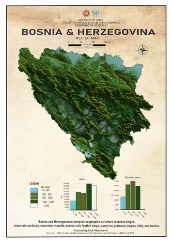
This map was first prepared in QGIS by processing elevation data and defining the spatial extent of Bosnia and Herzegovina. The prepared data was then exported to Blender to create a 3D terrain model. Finally, visual styling and layout were completed in CorelDRAW for presentation purposes.
The map was created under the mentorship of Professor Edin Hadžimustafić, Associate Professor in the fields of Physical Geography and Geographic Information Systems at the University of Tuzla, and I am deeply grateful for his invaluable guidance.
I also want to express my heartfelt gratitude to both my professors and teaching assistants for all the guidance and support they have provided throughout my studies in the fields of Geography and Tourismology.
Thank you very much!
Reviewed by gabrieldeluca 11 months, 1 week ago

This Map is made available under the CC-0 license.

Flagship membership

Flagship membership

Large membership

Large membership

Large membership

Large membership

Large membership

Large membership

Large membership

Large membership

Large membership

Large membership


