
This Map is made available under the CC-0 license.
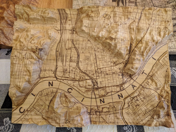
QGIS was the workhorse for all GIS data acquisitions and manipulations. QGIS data outputs were an 'optimized' elevation raster, and OSM-based vector linework. A 3D model was then generated in Blender and exported to Fusion360 (when it was free) for tool-path generation. A Shapeoko XL milled the ~14x20x2.5in Ohio Valley yellow poplar stock. The wood burn linework was done by a custom 5W laser CNC attachment. Approximately a dozen were produced.
This project was done several years ago (~v3.4) and 3d capabilities have improved significantly since then. QGIS may be capable of generating an STL file natively now. I would probably still need Blender to refine the 3d model complexity for various terrain types.
Thank you very much, and congratulations on the work done!!
Reviewed by gabrieldeluca 11 months ago

This Map is made available under the CC-0 license.

Flagship membership

Flagship membership

Large membership

Large membership

Large membership

Large membership

Large membership

Large membership

Large membership

Large membership

Large membership

Large membership


