
This Map is made available under the CC-0 license.
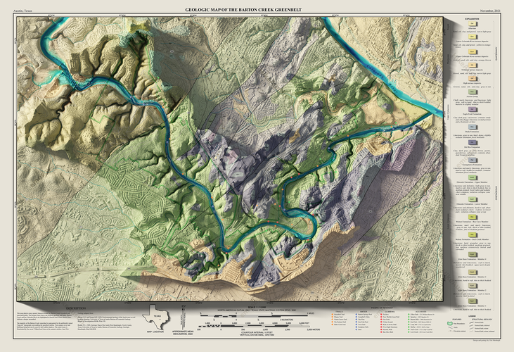
All GIS data & cartography were created in QGIS ~3.12. Ray-traced terrain and layout shading was created in Blender. Geology was assembled from USGS and Texas sources by yours truly.
Streambed was accentuated in blue hues by depth of FEMA base-flood elevation cross sections. LiDaR-based DEM was used for 3d surface, while forest canopy surface was generated procedurally by landcover raster, and finally supplemented by building footprint extrusions based on OSM building footprints. The watershed is artificially raised above the surrounding landscape.
Thank you very much.
Reviewed by gabrieldeluca 11 months, 2 weeks ago

This Map is made available under the CC-0 license.

Flagship membership

Flagship membership

Large membership

Large membership

Large membership

Large membership

Large membership

Large membership

Large membership

Large membership

Large membership

Large membership


