
This Map is made available under the CC-0 license.
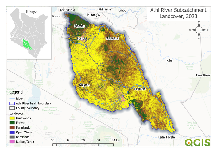
This map was created in QGIS by Dennis Ojwang from Kenya as part of research to map the land-cover and land use within the upper Athi River sub-catchment. Supervised classification of Landsat 8 data was used to discern different cover classes within the catchment area. The map layout was completely prepared and designed using QGIS.
Thank you!
Reviewed by gabrieldeluca 9 months, 1 week ago

This Map is made available under the CC-0 license.

Flagship membership

Flagship membership

Large membership

Large membership

Large membership

Large membership

Large membership

Large membership

Large membership

Large membership

Large membership

Large membership


