This Map is made available under the CC-0 license.
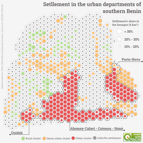
This map, produced using QGIS, illustrates a structured spatial analysis based on a hexagonal grid. Geoprocessing operations were applied to intersect settlements with the grid. A rule-based symbology was used to visually categorize the hexagons and finally, the geometry generator was employed, combining the buffer function and the boundary function.
Nice, thank you!
Reviewed by gabrieldeluca 1 year ago

This Map is made available under the CC-0 license.

Flagship membership

Flagship membership

Flagship membership

Large membership

Large membership

Large membership

Large membership

Large membership

Large membership

Large membership

Large membership

Large membership