
This Map is made available under the CC-0 license.
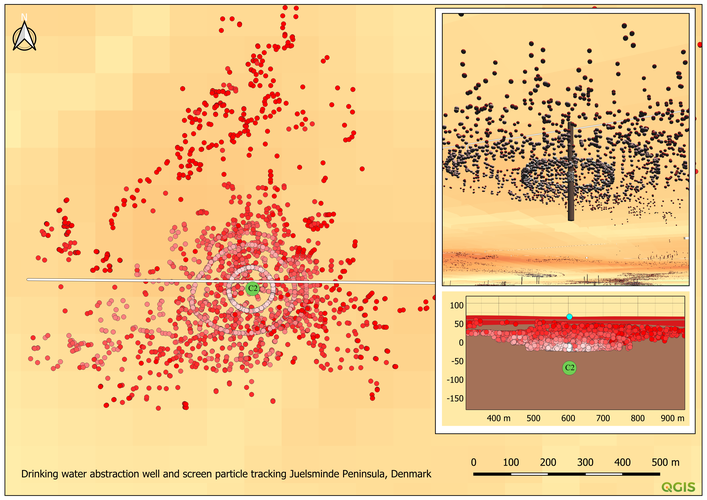
A three part QGIS map story using 2D-Window, 3D-Window and Elevation Profile showing a geological model of raster layers, a drinking water abstraction well constructed by a geometry generator and hydrological calculated tracking of groundwater particle moving to the abstraction well. The particle tracking is styled by a graduated transport time color. Work is part of the Danish Environmental Protection Agency groundwater mapping in Denmark.
Thank you for your submission! For this part of the hub we are looking for cartographic products that we can showcase in our map gallery. Would you consider putting your project into a layout and producing an awesome looking print layout that tells the story of your data? Please feel free to resubmit when you have something in line with that. Thanks!
Reviewed by timlinux 1 year ago
Beautiful thanks so much!
Reviewed by timlinux 1 year ago

This Map is made available under the CC-0 license.

Flagship membership

Flagship membership

Large membership

Large membership

Large membership

Large membership

Large membership

Large membership

Large membership

Large membership

Large membership

Large membership


