
This Map is made available under the CC-0 license.
This map was produced using QGIS. The basemap combines hillshading, rendered in Blender, with a slope analysis generated in QGIS, both derived from the 2‑m resolution ArcticDEM (version 4.1) digital elevation model.
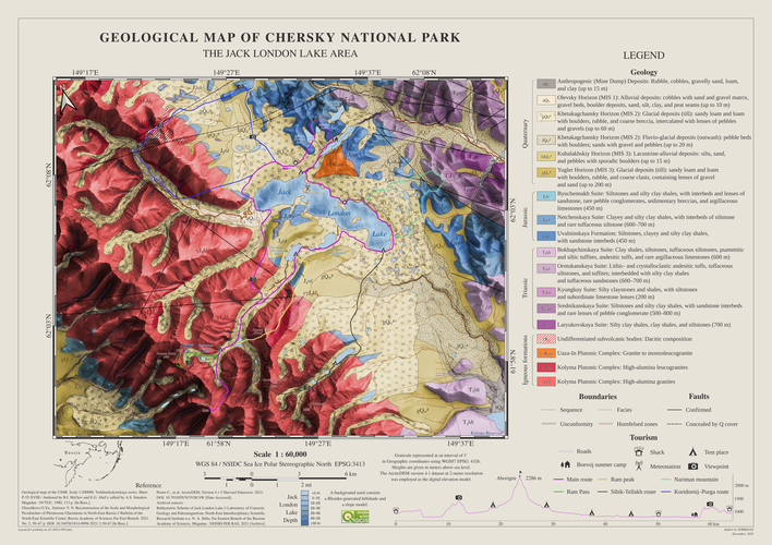
Geological data were digitized from the USSR State Geological Map. Tourist routes were compiled from the Soviet-era map of Jack London Lake and the Wikiloc database.
For cartographic symbology, the FGDC Geologic Patterns standard was applied to Quaternary deposits. Topographic and geological cross-sections were generated using the Profile Tool plugin, and UTF‑8 encoding ensured the correct display of all geological symbols and indices in the legend.
Nice map! Thank you!
Reviewed by gabrieldeluca 3 months ago

This Map is made available under the CC-0 license.

Flagship membership

Flagship membership

Large membership

Large membership

Large membership

Large membership

Large membership

Large membership

Large membership

Large membership

Large membership

Large membership


