
Creator:
Uploaded:
Downloads:
Description:
Map Tags
QGIS Map Gallery is a collection of maps created with QGIS. They are a great way to learn how to use QGIS and to get inspiration for your own maps.
2 records found.
by Kazakov, 24 March 2025
Updated on 26 March 2025
by Vesanto, 26 March 2025
Updated on 31 March 2025
| Name | Creator | Upload Date | |||
|---|---|---|---|---|---|

|
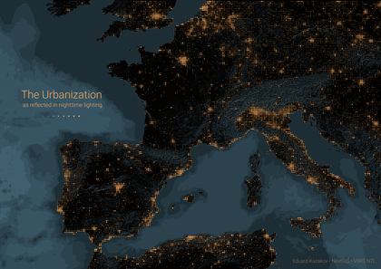
The Urbanization as reflected in nighttime lighting | 810 | Kazakov | 24 Mar. 2025 | |

|
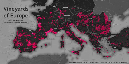
European Vineyards | 524 | Vesanto | 26 Mar. 2025 |
Creator:
Uploaded:
Downloads:
Description:

Flagship membership

Flagship membership

Large membership

Large membership

Large membership

Large membership

Large membership

Large membership

Large membership

Large membership

Large membership

Large membership


