


Model
Model Tags
All Models
ℹ️
QGIS models are a set of processing algorithms that can be run in a sequence to automate a task.
30 records found.

Generate Global MGRS GZD polygons
by Klas Karlsson, 31 December 2020
REQUIRES "Lat Lon Tools" plugin. The model will generate a polygonlayer with all Grid Zone …
Updated on 28 May 2024
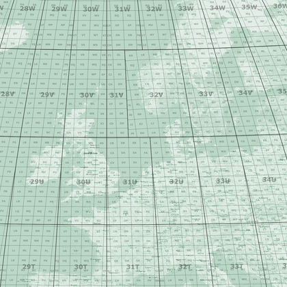
MGRS 100km squares for selected MGRS GZD zones
by Klas Karlsson, 31 December 2020
REQUIRES "Lat Lon Tools" plugin. Required GZD polygons can be generated with the MGRS GZD …
Updated on 27 May 2024
MGRS 1km Grid lines for selected GZD polygons
by Klas Karlsson, 31 December 2020
REQUIRES "Lat Lon Tools" plugin. GZD polygons can be generated with the MGRS GZD model. …
Updated on 27 May 2024

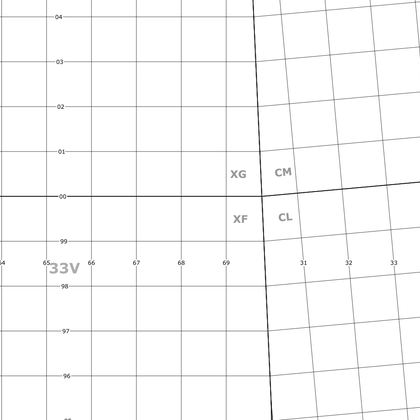
MGRS Corner label points for MGRS polygons
by Klas Karlsson, 31 December 2020
This model converts MGRS polygons created with the MGRS 100km model, to points that can …
Updated on 27 May 2024
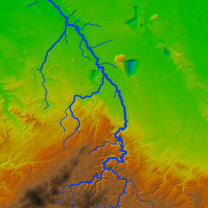
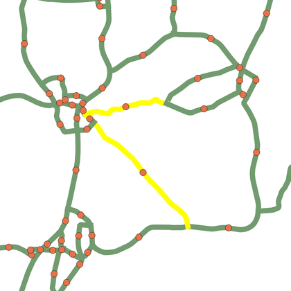
Stream delineation
by Hans Kwast, 20 July 2021
Creates a filled DEM from DEM tiles, clipped and reprojected to the bounding box polygon. …
Updated on 15 December 2024
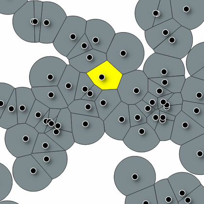
Non-overlapping buffer from points
by V, 21 July 2021
The algorithm creates non-overlapping buffer from points using voronoi and intersection operations.
Updated on 29 May 2024
Split polygon in parts based on categorized points
by V, 22 July 2021
This algorithm splits a polygon based on categorized points in smaller polygons.
Updated on 29 May 2024
Centroid for largest part of multipart polygon
by V, 23 July 2021
This algorithm calculates the centroid for the largest part of a multipart polygon.
Updated on 28 May 2024
Catchment Delineation
by Hans Kwast, 24 July 2021
Delineates the catchment for specified coordinates of an outlet and clips the DEM to the …
Updated on 15 December 2024
Topographic Wetness Index
by Hans Kwast, 24 July 2021
Calculates the Topographic Wetness Index (TWI) from a Digital Elevation Model
Updated on 30 May 2024
Center (centroid) of a line string
by V, 30 July 2021
This algorithm calculates the center (centroid) of every part of a line string and places …
Updated on 27 May 2024
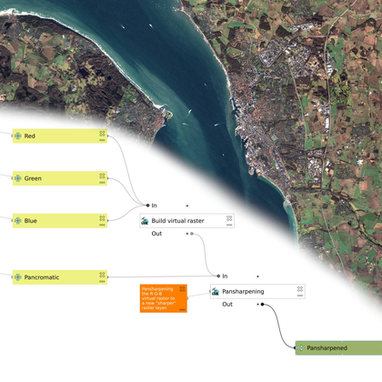
Simple Pansharpen Tool
by Klas Karlsson, 13 February 2022
This model takes all the steps required to create a sharp RGB image from multi …
Updated on 28 May 2024
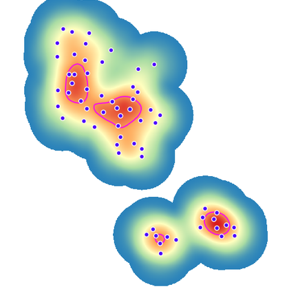
Home Range Analysis By Kernel Density Estimation
by Frate, 13 February 2022
The model created with the Graphical Model Builder in QGIS 3.16 allows to calculate the …
Updated on 28 May 2024
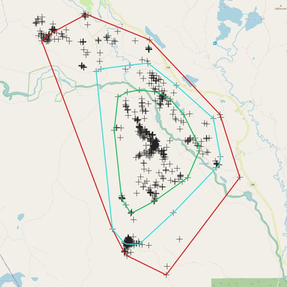
Home Range Analysis By Minimun Convex Polygon
by Frate, 13 February 2022
The model was created with the Graphical Model Builder in QGIS 3.16/3.22 and it allows …
Updated on 29 May 2024
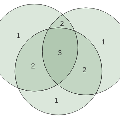
Count Polygon Overlap
by Jenkins, 19 March 2022
Given a set of overlapping polygons (like species ranges), this model outputs a layer of …
Updated on 30 May 2024
Borders
by Jenkins, 19 March 2022
Given a set of adjacent polygons, this model outputs an "internal borders" layer containing lines …
Updated on 24 November 2024
Order 1 transformer by GCPs
by Gabriel, 24 March 2022
Performs the order 1 polynomial transformation using start and end points of line geometries stored …
Updated on 28 May 2024
Quick Parcel Digitizer
by Anaba, 14 April 2022
The purpose of the model is to assist physical and spatial planners to develop spatial …
Updated on 28 May 2024
ROI-zeromean
by Weis, 30 May 2022
Compute zero-mean values for polygon regions of interest (ROI) and count pixels below a threshold …
Updated on 29 January 2025
Index Grid Creator
by Klas Karlsson, 30 September 2022
Use the tool to quickly create a map index you can overlay any map to …
Updated on 28 May 2024


