
This Model is made available under the CC-0 license.
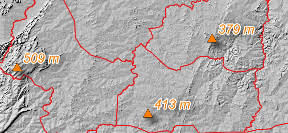
This algorithm is used to generate, from a digital elevation model (DEM) and the boundaries of an area, the highest points for each entity making up the area. The model is calibrated for 30m resolution DEM.
Thank you very much!
Reviewed by gabrieldeluca 9 months, 2 weeks ago

This Model is made available under the CC-0 license.

Flagship membership

Flagship membership

Large membership

Large membership

Large membership

Large membership

Large membership

Large membership

Large membership

Large membership

Large membership

Large membership


