
Model
Model Tags
Model tagged with: dem
ℹ️
QGIS models are a set of processing algorithms that can be run in a sequence to automate a task.
2 records found.
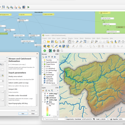
Stream and catchment delineation
by Hans Kwast, 01 December 2024
Calculate streams and catchment boundary for a given extent and outlet. The model will automatically …
Updated on 03 December 2024
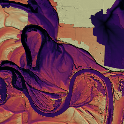
Height Above Nearest Drainage (HAND)
by Hans Kwast, 01 December 2024
Create relative digital elevation models (REMs) using the Height Above Nearest Drainage (HAND) algorithm. Inputs …
Updated on 03 December 2024
| Name | Creator | Upload Date | |||
|---|---|---|---|---|---|

|
Stream and catchment delineation | 2,262 | Hans Kwast | 01 Dec. 2024 | |

|
Height Above Nearest Drainage (HAND) | 1,798 | Hans Kwast | 01 Dec. 2024 |


