This Screenshot is made available under the CC-0 license.
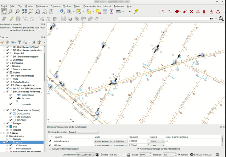
This screenshot showcases an application dedicated to wastewater network management. It displays various kind of objects. The data is stored in PostGIS and is fully topological, with layers linked to each others and data described through linear referencing. QGIS has been enhanced with a dedicated plugin to achieve most common operations on the network, improving efficiency for QGIS CAD users.
Thank you!
Reviewed by gabrieldeluca 10 months, 4 weeks ago

This Screenshot is made available under the CC-0 license.

Flagship membership

Flagship membership

Flagship membership

Large membership

Large membership

Large membership

Large membership

Large membership

Large membership

Large membership

Large membership

Large membership