This Processing Script is made available under the CC-0 license.
download_wcs_layer
          from math import floor, ceil

from qgis.PyQt.QtCore import QCoreApplication, QVariant, QUrl, QUrlQuery
from qgis.PyQt.QtNetwork import QNetworkRequest, QNetworkReply
from qgis.core import (
    QgsProcessing,
    QgsProcessingAlgorithm,
    QgsProcessingParameterString,
    QgsProcessingParameterExtent,
    QgsProcessingParameterNumber,
    QgsProcessingParameterRasterLayer,
    QgsProcessingParameterRasterDestination,
    QgsProcessingContext,
    QgsProcessingException,
    QgsProcessingParameterExtent,
    QgsCoordinateReferenceSystem,
    QgsCoordinateTransform,
    QgsRasterLayer,
    QgsNetworkAccessManager,
    QgsRectangle,
    QgsProject,
    QgsDataSourceUri,
)
from qgis.utils import iface


class DownloadWCSLayerAlgorithm(QgsProcessingAlgorithm):
    """
    Downloads a WCS layer with a specified bounding box and resolution.
    """

    # Algorithm metadata
    def name(self):
        return "download_wcs_layer"

    def displayName(self):
        return "Download WCS Layer"

    def group(self):
        return "Raster"

    def groupId(self):
        return "raster"

    def shortHelpString(self):
        return """
        Downloads a WCS layer with a specified bounding box and resolution.
        The bounding box is rounded to the resolution.
        Uses QGIS Network Manager for HTTP requests.
        """

    def initAlgorithm(self, config=None):
        self.addParameter(
            QgsProcessingParameterRasterLayer(
                "wcs_layer",
                "WCS Layer",
            )
        )

        # Bounding box (extent)
        self.addParameter(
            QgsProcessingParameterExtent(
                "extent",
                "Bounding Box (Extent)",
                defaultValue='',
            )
        )

        # Output resolution (pixel size in CRS units)
        self.addParameter(
            QgsProcessingParameterNumber(
                "resolution",
                "Output Resolution (CRS units per pixel)",
                type=QgsProcessingParameterNumber.Double,
                defaultValue=1,
                minValue=0.000001,
            )
        )

        # Output raster layer
        self.addParameter(
            QgsProcessingParameterRasterDestination(
                "output_raster",
                "Output Raster Layer",
            )
        )

    def processAlgorithm(self, parameters, context, feedback):
        # WCS Layer
        wcs_layer = self.parameterAsRasterLayer(parameters, "wcs_layer", context)

        if not wcs_layer.providerType() == "wcs":
            error_txt = f"Input layer is not a WCS layer: {wcs_layer.providerType()}"
            raise QgsProcessingException(error_txt)

        u = QgsDataSourceUri()
        u.setEncodedUri(wcs_layer.source())
        wcs_url = u.param('url')
        wcs_coverage_id = u.param('identifier')
        wcs_crs = u.param('crs')

        # Resolution
        resolution = self.parameterAsDouble(parameters, "resolution", context)

        layer_minimum_resolution = min(wcs_layer.rasterUnitsPerPixelX(), wcs_layer.rasterUnitsPerPixelY())
        if layer_minimum_resolution > resolution:
            resolution = layer_minimum_resolution
            feedback.pushInfo(f"Resolution raised to WCS minimum resolution: {resolution}")

        # Extent
        extent = self.parameterAsExtent(parameters, "extent", context)
        extent_crs = self.parameterAsExtentCrs(parameters, "extent", context)

        if not extent_crs == wcs_crs:
            source_crs = QgsCoordinateReferenceSystem(extent_crs)
            target_crs = QgsCoordinateReferenceSystem(wcs_crs)
            transform = QgsCoordinateTransform(source_crs, target_crs, context.project())
            extent = transform.transformBoundingBox(extent)

        rounded_extent = self.round_extent_to_resolution(extent, resolution)
        feedback.pushInfo(f"Rounded extent: {rounded_extent}")

        # Output
        output_path = self.parameterAsOutputLayer(parameters, "output_raster", context)

        # Calculate width and height in pixels
        width = int((rounded_extent.width() / resolution) + 0.5)
        height = int((rounded_extent.height() / resolution) + 0.5)
        feedback.pushInfo(f"Width: {width}, Height: {height}")

        # Construct the WCS GetCoverage request
        params = {
            "service": "WCS",
            "version": "1.0.0",
            "request": "GetCoverage",
            "coverage": wcs_coverage_id,
            "format": "image/tiff",
            "bbox": f"{rounded_extent.xMinimum()},{rounded_extent.yMinimum()},{rounded_extent.xMaximum()},{rounded_extent.yMaximum()}",
            "crs": wcs_crs,
            "response_crs": wcs_crs,
            "width": width,
            "height": height,
        }

        request_url = QUrl(wcs_url)

        query = QUrlQuery()
        for key, value in params.items():
            query.addQueryItem(key, str(value))
        request_url.setQuery(query)

        network_manager = QgsNetworkAccessManager.instance()
        request = QNetworkRequest(request_url)

        # Send the request and handle the response
        reply = network_manager.blockingGet(request)
        if reply.error() != QNetworkReply.NetworkError.NoError:
            error_txt = f"Network error: {reply.errorString()}"
            raise QgsProcessingException(error_txt)

        # Save the response to a TIFF file
        with open(output_path, "wb") as f:
            f.write(reply.content())

        feedback.pushInfo(f"Downloaded TIFF file to: {output_path}")

        # Load the raster layer into QGIS
        layer = QgsRasterLayer(output_path, "WCS Layer")
        if not layer.isValid():
            error_txt = "Failed to load the downloaded raster layer."
            raise QgsProcessingException(error_txt)

        context.addLayerToLoadOnCompletion(
            output_path,
            QgsProcessingContext.LayerDetails(
                "Downloaded WCS Layer",
                context.project(),
                "Downloaded WCS Layer",
            ),
        )

        return {"output_raster": output_path}

    def round_extent_to_resolution(self, extent, resolution):
        """
        Rounds the extent to a multiple of the resolution, but never shrinking the bbox.
        """
        x_min = floor(extent.xMinimum() / resolution) * resolution
        y_min = floor(extent.yMinimum() / resolution) * resolution
        x_max = ceil(extent.xMaximum() / resolution) * resolution
        y_max = ceil(extent.yMaximum() / resolution) * resolution

        return QgsRectangle(x_min, y_min, x_max, y_max)

    def createInstance(self):
        """
        Required method to create a new instance of the algorithm.
        """
        return DownloadWCSLayerAlgorithm()

# Register the algorithm
def classFactory(iface):
    return DownloadWCSLayerAlgorithm()
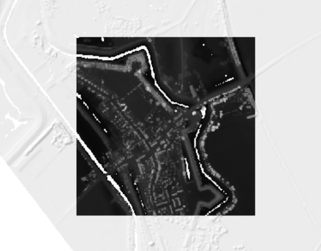
Downloads a WCS layer with a specified bounding box and resolution. The bounding box is rounded to the resolution. Uses QGIS Network Manager for HTTP requests.
(This script is a work around for the native QGIS algorithm "Clip Raster by Extent" which does not work in combination with WCS layers. As reported here: https://github.com/qgis/QGIS/issues/67061)

This Processing Script is made available under the CC-0 license.
Hi Raymond, thank you so much for your contribution! I'm marking the script as Requiring Update: I tested it in QGIS 3.44.9 using the service you mentioned in the issue report, and it saves an output-raster.tif file with the server response in XML containing: <ServiceException code="MissingParameterValue" locator="crs">msWCSGetCoverage(): WCS server error. Required parameter CRS was not supplied.</ServiceException>. In QGIS 4.2.1, it returns the Python AttributeError: type object 'QNetworkReply' has no attribute 'NoError'.
Reviewed by Gabrieldeluca 1 month, 2 weeks ago
Hi Raymond, thanks for the update. I can't get it to work. wcs_layer.source() doesn't seem to include a crs parameter. Therefore, wcs_crs stores an empty string, and the request_query for the new download includes empty crs and response_crs parameters, returning the same error as before.
Reviewed by Gabrieldeluca 1 month, 1 week ago

Flagship membership

Flagship membership

Flagship membership

Large membership

Large membership

Large membership

Large membership

Large membership

Large membership

Large membership

Large membership

Large membership