
This Style is made available under the CC-0 license.
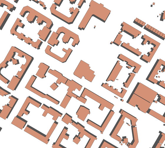
A much faster alternative to the QGIS built in 2.5D style. It simulates 3D from a point above the center of the map, presenting objects gradually more oblique towards the map edges. You control the effect by a single value in the "Offset" data defined override. If you have buildings with the elevation as an attribute value, you can use this to control the effect with an expression in stead of a simple value. (Designed for projected layers with the same project CRS)
Tested with projected/unprojected mix of CRS and it works as expected. It will give an error symbology for unprojected layers and if layer crs is different from project crs.
Reviewed by klakar 2 months, 3 weeks ago

This Style is made available under the CC-0 license.

Flagship membership

Flagship membership

Large membership

Large membership

Large membership

Large membership

Large membership

Large membership

Large membership

Large membership

Large membership

Large membership


