This Style is made available under the CC-0 license.
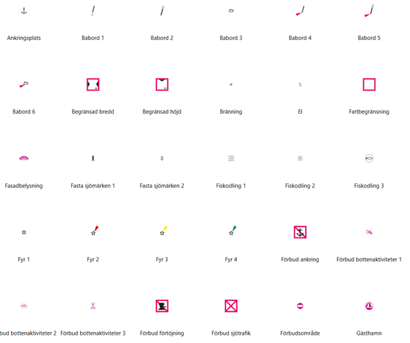
This style library provides a collection of Swedish nautical chart symbols for use in QGIS. The symbols are inspired by the cartographic conventions used in Swedish nautical charts and are intended for mapping, planning, visualization, education, and GIS applications related to coastal and inland waterways.
The library includes a wide range of symbols representing:
All symbols are supplied as embedded SVG graphics within the style file, making the library fully self-contained and portable. No additional SVG files, plugins, or external resources are required after installation.
Features - Single XML style library for QGIS - Embedded SVG symbols (no external dependencies) - Suitable for both coastal and inland waterway mapping - Compatible with modern QGIS versions
Disclaimer This style library is intended as a cartographic resource and visual aid for GIS users. It is not an official nautical chart product and must not be used for navigation.
Thank you!
Reviewed by gabrieldeluca 1 month, 3 weeks ago

This Style is made available under the CC-0 license.

Flagship membership

Flagship membership

Flagship membership

Large membership

Large membership

Large membership

Large membership

Large membership

Large membership

Large membership

Large membership

Large membership